The South Passage is mostly open water now and certainly passable but yet the Algoma Intrepid is eastbound in the Straits and just took Round Island Passage on way to Sarnia. My only guess as to the Algoma Niagara course change would be that they entered the South Pass and realized it was officially closed to traffic and did an about face. Typically there is a Notice to Mariners put out in Dec (?) that gives the closure dates of the SP from the Mac Bridge to Poe Reef Lt.
The Algocanada is inbound Cheboygan which is at the eastern end of the Passage for the US Oil dock and no ice to speak of.
Algoma Niagara question
-
guest_ahsland69
Re: Algoma Niagara question
Comments from Jon Paul and algowest are very interesting, but I tell you, fro what I saw on the AIS, it sure did look like Algoma Niagara ventured into the south channel and then turned around and "high-tailed" it out of there is short order!
-
Guest Jon Paul
Re: Algoma Niagara question
Typically the South Passage between Bois Blanc and mainland lower peninsula is closed in Winter partly due to those living on the island using an ice bridge to cross over. It had been ice free most of the winter until the colder night Temps of the past week caused a freeze over but as of this morning there were still open spots and shifting of the pack.
Re: Algoma Niagara question
If I'm interpreting this correctly, that "south channel" between Bois Blanc Island and Cheboygan is seasonally closed after Soo Locks close each season.
Here's a quick notification from 2019 season:
https://www.cheboygannews.com/story/new ... 287806007/
Here's a quick notification from 2019 season:
https://www.cheboygannews.com/story/new ... 287806007/
-
Guest
Re: Algoma Niagara question
Sorry, I referred to Algoma Intrepid in my last comments. I meant to refer to Algoma Niagara.Guest wrote: ↑February 19, 2024, 1:26 amAfter closer analysis, I believe I discovered the answer to my question. Ice. Probably an impenetrable ice field between Bois Banc Island and the shore line of the lower peninsula, causing Intrepid to go around the blockage and use the stretch between Bois Blanc and Mackinac Islands, instead.guest wrote: ↑February 18, 2024, 2:23 pm Just curious, since Algoma Niagara is currently enroute to Milwaukee from Goderich with salt, why is she heading eastbound off the southeast tip of Bois Blanc Island at 10+ knots? Weather, ice or damage? Again, just curious.
-
Guest
Re: Algoma Niagara question
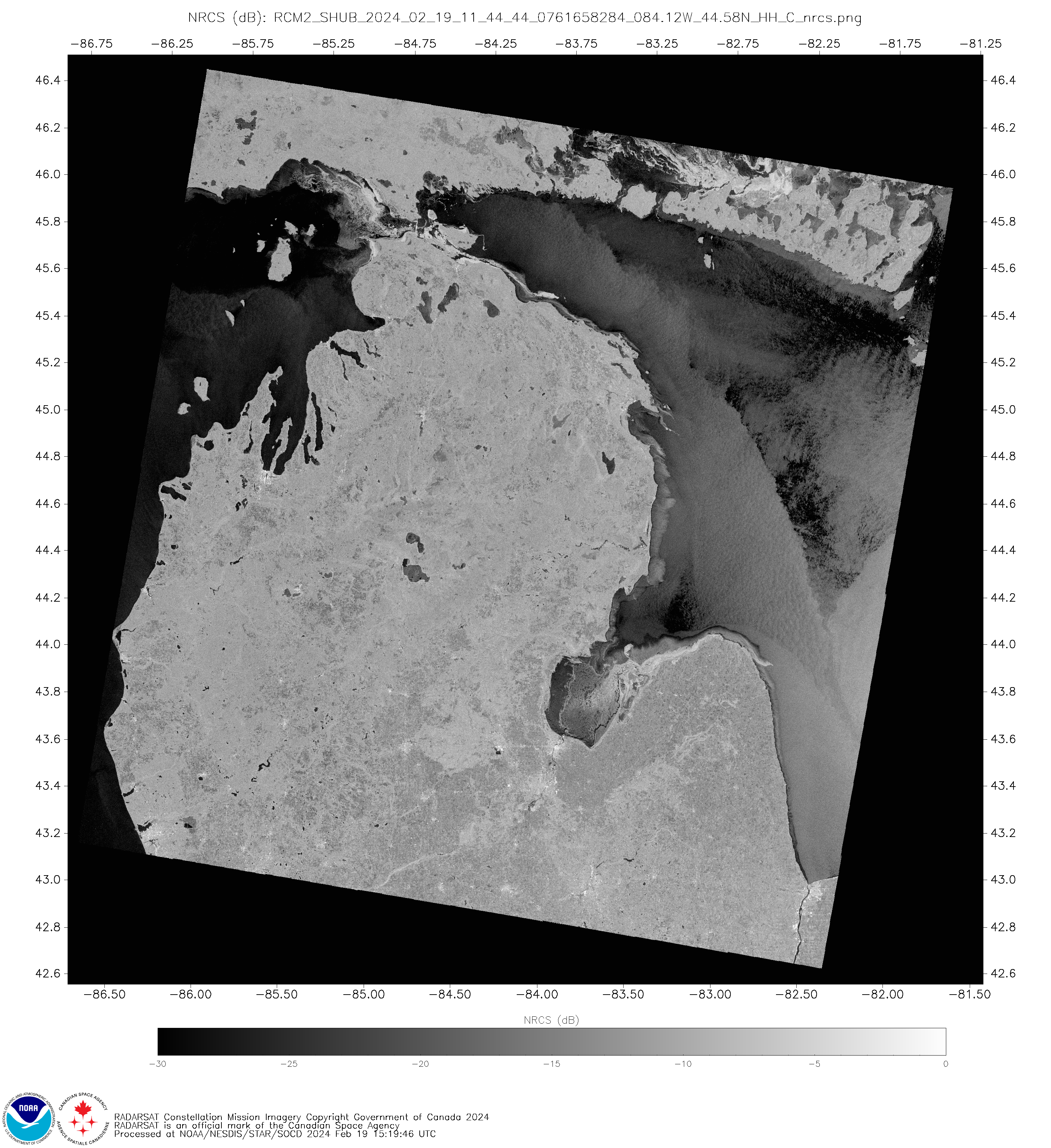
Here's a Synthetic Aperture Radar (SAR) from NOAA's STAR SOCD Program website parts of Lake Michigan and Lake Huron. https://www.star.nesdis.noaa.gov/socd/m ... C_nrcs.png
Image is for February 19, 2024 at 1144UTC or 6:44am EST.
Image is for February 19, 2024 at 1144UTC or 6:44am EST.
-
Guest
Re: Algoma Niagara question
After closer analysis, I believe I discovered the answer to my question. Ice. Probably an impenetrable ice field between Bois Banc Island and the shore line of the lower peninsula, causing Intrepid to go around the blockage and use the stretch between Bois Blanc and Mackinac Islands, instead.guest wrote: ↑February 18, 2024, 2:23 pm Just curious, since Algoma Niagara is currently enroute to Milwaukee from Goderich with salt, why is she heading eastbound off the southeast tip of Bois Blanc Island at 10+ knots? Weather, ice or damage? Again, just curious.
-
guest
Algoma Niagara question
Just curious, since Algoma Niagara is currently enroute to Milwaukee from Goderich with salt, why is she heading eastbound off the southeast tip of Bois Blanc Island at 10+ knots? Weather, ice or damage? Again, just curious.